OUR SERVICES
Specializing in Professional Land Surveying Services, Customized to Our Client’s Needs
do you have a construction project we can help with?
Quality Survey, Personalized Customer Service
Experience You Can Trust, Solutions You Can Depend On
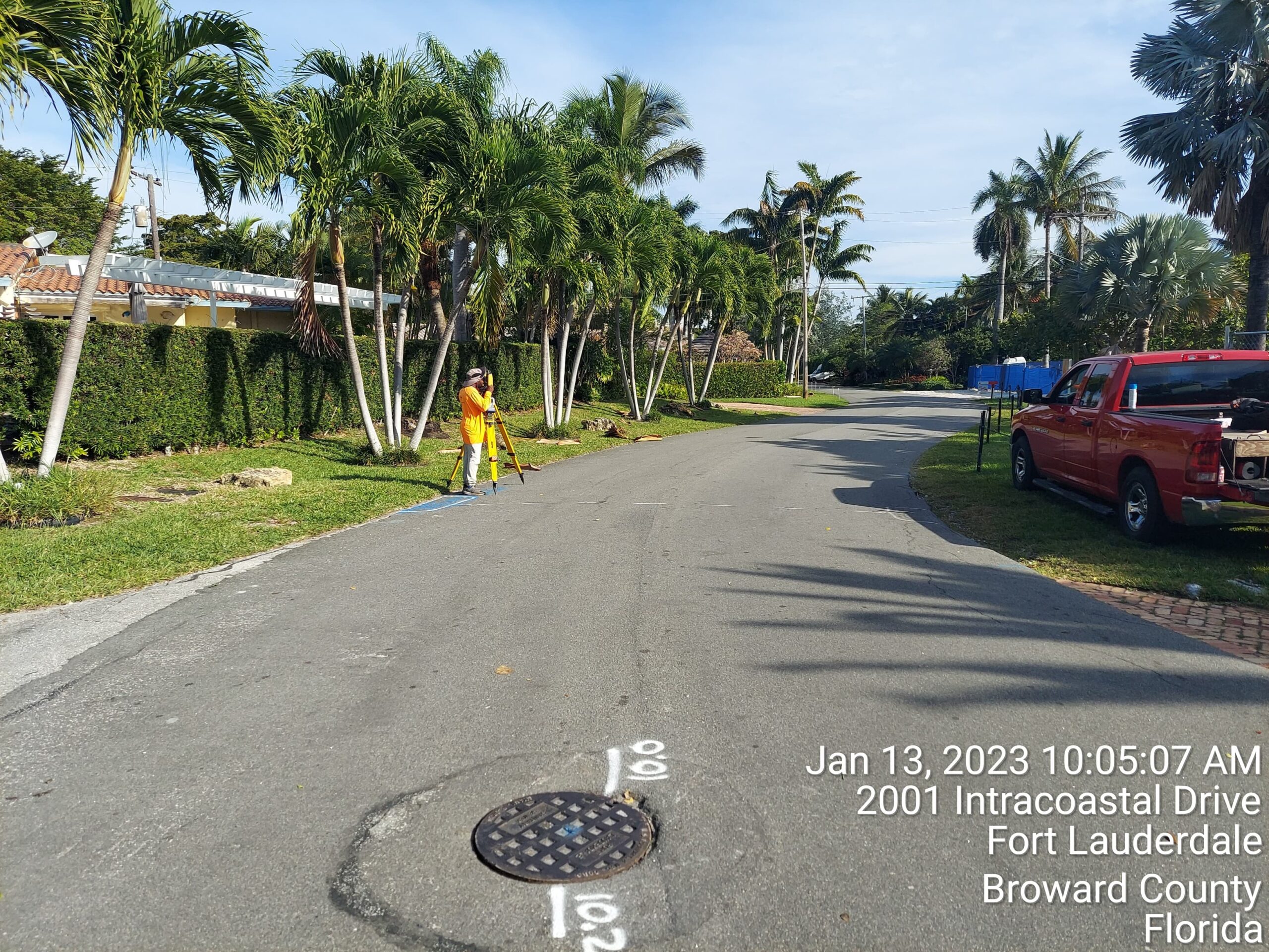
With over 40 years dedicated exclusively to topographic studies in Florida, Pulice Land Surveyors brings unparalleled expertise to the table. Our methodologies have Deen honed over time, resulting in highly effective solutions that offer greater precision and efficiency in every project we undertake. As the company with the largest number of registered Plats in South Florida, our unique expertise in this service is unmatched.
ALTA-NSPS LAND TITLE SURVEYS
ALTA Land Title Survey, commonly contracted by title companies, lenders, or attorneys for commercial property transactions, adheres to standards set jointly by the American Land Title Association (ALTA) and the National Society of Professional Surveyors (NSPS). This survey provides comprehensive information crucial for propert) purchases, refinances, or improvements.

PLATTING SERVICE
Expert assistance in creating plat maps, essential for subdividing land and establishing property boundaries.

BOUNDARY SURVEYS
Determines the property lines of a parcel of land described in a title. It will also indicate the extent of any easements or encroachments and may show the limitations imposed on the property by state or local regulations.
Boundary surveys are done to gather data so that a scale drawing can be performed and are typically required when a homeowner wants to close on a mortgage. Sometimes called plats, these drawings illustrate the property lines, the distance along these lines, bearings, and total acreage. The plat also shows any improvements made to the property, as well as any encroachments. Property corners will also be flagged and any missing pins will be reset.

TOPOGRAPHIC SURVEYS
Used to identify and map the contours of the ground and existing features on the surface of the earth or slightly above or below the earth’s surface (i.e. trees, buildings, streets, walkways, manholes, utility poles, retaining walls, etc.).
Topographic surveys are done to determine the elevation of an entire piece of property. It takes note of all the natural and artificial physical features on the site and gives vertical information with the relative heights of the ground and other identified features.

ROUTE SURVEYS
Detailed surveys along designated routes, such as roads, railways, or utility corridors, facilitating infrastructure planning and construction.

FAA-IA SURVEYS
Surveys compliant with Federal Aviation Administration (FAA) regulations, ensuring safety and compliance for aviation-related projects.

CONDOMINIUM EXHIBITS
Expertly crafted exhibits outlining condominium unit boundaries, common areas, and other relevant details for legal and development purposes.
LAND PLANNING SERVICES
Strategic planning and consulting services to optimize land use and development projects, tailored to meet regulatory requirements and client objectives.

DISTANCE SURVEYS
Precise measurement of distances between points on land, crucial for property assessment, boundary determination, and infrastructure planning.
As- BUILT SURVEYS
Unlike many land surveys, as-built surveys are done after buildings or other improvements are added to the land or after they are complete, as-built maps are used during the middle of a construction project. As-built maps show improvements to the land, as they exist at a particular point in time.
As-built surveys allow property owners to obtain a Certificate of Occupancy and are done once a construction project is finished. The survey will show all the new improvements on the property. It will also verify that the location and elevation of completed works are in line with the governing jurisdiction and approved plan.
FEMA Flood Elevations Certificates
Identifies Special Flood Hazard Areas (SFHA) are properly elevated. A Flood Elevation Certificate is a document used to provide data to help properly rate properties for flood insurance. It uses collected data from the field and cross-examines it with the Flood Insurance Rate Map (FIRM) to determine the insurance rate or if flood insurance is required at all. Factors include:
The property location on the FIRM
The elevation of the house
Adjacent ground level
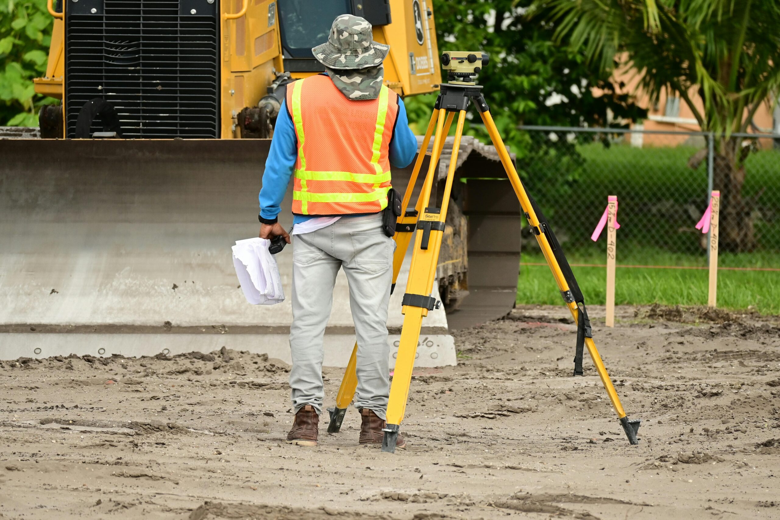
CONSTRUCTION SURVEY – STAKING AND LOCATES
Or building surveying (otherwise known as «staking», «stake-out», «lay-out» or «setting-out») is to stake out reference points and markers that will guide the construction of new structures such as roads or buildings.
Construction staking surveys are done to mark where proposed features are to be built. This is done to ensure that all proposed features are accounted for and that their locations match the construction plans. The locations of these features are taken directly from the construction plans
MORTAGE LOCATION SURVEY
Surveys conducted to determine property boundaries and building locations, essential for mortgage transactions and property assessments.
TREE SURVEYS
Identification and mapping of trees on a property, providing valuable data Tor landscaping, conservation, and development projects.
COMMERCIAL
Ensuring Success in Business Ventures
Commercial surveys play a pivotal role in ensuring the success of business ventures by providing accurate land use assessments, ensuring compliance with regulations, and facilitating efficient project execution. These surveys are indispensable tools for various stakeholders, including lenders, buyers, title companies, and others, enabling them to evaluate properties comprehensively and assess associated risks and benefits.
At PLS, we specialize in providing individualized proposals for commercial projects tailored to meet the unique needs of each client. Our commercial surveying services encompass a wide range of features essential for business-use properties, including:
- Compliance with ALTA and NSPS standards
- Identification of property corners and boundary lines, including public Right of Ways
- Observation of improvements, utilities, parking spaces, fences, and other significant features
- Documentation of recorded and observed easements
Our extensive experience spans a diverse array of projects, including schools, parks, bridges, tunnels, commercial high-rises, roads, and large-scale utility infrastructure projects. As trusted commercial surveyors serving Florida, we offer a comprehensive range of services, including:
- ALTA Surveys
- Subdivisions
- Construction Staking
- Settlement Monitoring
- ADA Surveys
- Hazmat Certified Surveys
- Precision Alignment
- Machine Control
- Feasibility Studies
Whether you require a survey for property sale, refinance, or development, our team is equipped to meet your needs with professionalism, accuracy, and efficiency. Trust PLS for your commercial surveying needs and ensure that you receive the precise and reliable data necessary for informed decision-making and successful project outcomes.

RESIDENTIAL
Ensuring Clarity and Confidence in Property Ownership
Whether you’re purchasing a new home or considering additions to your existing property, understanding property boundaries is essential. Property surveys serve as crucial tools in this regard, providing accurate delineation of land boundaries and confirming established property lines.
At PLS, we recognize the significance of property surveys for homeowners, offering comprehensive residential surveying services tailored to meet your specific needs. Our surveys not only establish legal boundaries but also play a vital role in obtaining permits for major renovation projects, ensuring compliance with lender title insurance policies, and facilitating informed decision-making.
Key aspects of our residential surveying services include:
- Definition of property boundaries
- Requirement fulfillment for mortgage lenders and title companies during property transactions
- Facilitation of home renovations and installations. such as fences, through accurate boundary identification
We offer various types of property surveys to cater to diverse requirements including:
- Land surveys: Detailing parcel boundaries
- Topographic surveys: Illustrating land plane and elevation often required for site work
- As-built surveys: Identifying property lines and permissible improvements or additions
- Residential site plan surveys: Essential for obtaining building permits, showcasing existing structures and proposed improvements
Our expertise extends to providing additional services such as FEMA Elevation Certificates, floodplain surveys, easements, lot line adjustments, legal descriptions, and more. With PLS you can rest assured that your residential surveying needs will be addressed with precision, professionalism and adherence to local regulations.
Trust PLS for your residential surveying requirements and gain the clarity and confidence needed to make informed decisions regarding your property.

MUNICIPALITIES
Facilitating Sustainable Development and Infrastructure.
Land surveying plays a pivotal role in municipal planning, enabling the establishment of accurate maps, facilitating commercial and residential development, and enhancing property management. In the contemporary landscape, ground control forms the bedrock of geospatial information crucial for the effective management of cities and towns.
At PLS, we collaborate closely with municipal officials and contractors, leveraging cutting-edge technologies to ensure fast and precise data collection for development projects. Our team adheres to stringent safety protocols and possesses extensive experience in delivering services within tight deadlines. Professionally registered, licensed, and experienced in Florida, our surveyors boast decades of experience, guaranteeing unmatched expertise and reliability.
Defining municipal boundaries holds significant importance for various reasons:
- Planning and Development: Accurate maps aid in land use planning, zoning, and urban development by providing insights into existing physical and man-made features.
- Infrastructure Management: Maps facilitate management t and upkeep of critical infrastructure, including roads, bridges, water and sewer systems, and emergency services.
- Emergency Response: Precise maps enable swift incident response and aid in disaster management and recovery planning.
- Asset Management: Property maps assist in managing public assets such as parks, buildings, and equipment.
- Taxation and Revenue Generation: Maps aid in determining tax assessments, ensuring municipalities generate essential revenue for service provision.
Roads, bridges, and tunnels serve as vital components of the transportation network and require regular maintenance and expansion to accommodate economic growth. PLS offers comprehensive road and highway construction surveying services, providing progressive data to support infrastructure sustainability and development initiatives.
Safety remains our utmost priority. Our road surveyors are fully compliant with ISNetworfd, PEC/Premier and PICS safety standards, ensuring a secure working environment and accurate results. With an impeccable Health, Safety, and Environmental record, PLS maintains a steadfast commitment to excellence in every endeavor.
CEMETERIES
Offering Specialized Service for Cemeteries
Pulice Land Surveyors specializes in offering tailored solutions for cemeteries, including our signature Garden Map Books and site maps. These customized maps delineate detailed sections of memorial parks, including markers, lots, roads, and mausoleums, facilitating efficient cemetery management and gravesite identification.
Our cemetery surveys serve the dual purpose of historic preservation and new gravesite layout. Accurate mapping preserves vital information susceptible to weathering or vandalism, ensuring the legacy of past generations remains intact. Additionally, meticulous surveying allows for the expansion of cemetery plots in older establishments, optimizing space utilization and preserving aesthetics.
As part of our comprehensive survey services, we:
- Locate existing structures, markers, and trees
- Layout reference markers for new or existing gardens
- Develop new garden layouts compliant with state laws
- Provide site plans for expansion and construction projects
Our Garden Map Books and site maps are invaluable tools for sales staff, maintenance personnel, and office administrators, facilitating plot location, inventory control, and operational efficiency.
Investing in accurate cemetery surveys not only enhances day-to-day operations but also contributes to the creation of visually appealing memorial gardens. Pulice also offers custom-sized display site maps with mounting and framing options, ensuring accessibility and convenience for clients.
With a wide range of products including Boundary Surveys, Topographic Surveys, Garden Design, and Mausoleum Layout, Pulice Land Surveyors stands as your trusted partner in cemetery management and development endeavors.

INDUSTRIAL SERVICE
At vero eos et accusamus et iusto odio dignissimos ducimus qui blanditiis praesentium voluptatum deleniti atque corrupti quos dolores et quas molestias excepturi sint occaecati cupiditate non provident, similique sunt in culpa qui officia deserunt mollitia animi, id est laborum et dolorum fuga. Et harum quidem rerum facilis est et expedita distinctio.
Nam libero tempore, cum soluta nobis est eligendi optio cumque nihil impedit quo minus id quod maxime placeat facere possimus, omnis voluptas assumenda est, omnis dolor repellendus. Temporibus autem quibusdam et aut officiis debitis aut rerum necessitatibus saepe eveniet ut et voluptates repudiandae sint et molestiae non recusandae. Itaque earum rerum hic tenetur a sapiente delectus, ut aut reiciendis voluptatibus maiores alias consequatur aut.
customers
Associations
Get A Quote Today
At vero eos et accusamus et iusto odio dignissimos ducimus qui blanditiis praesentium voluptatum deleniti atque corrupti quos dolores et quas.
